Second most common cause of maritime accidents after engine damage
Maps mark high-risk zones across 6 coastal regions nationwide
Data also available on Badanavi app and vessel GPS plotters
Floating debris such as discarded fishing nets and ropes entangling vessel propellers has averaged 427 incidents a year over the past five years, making it the second most common type of maritime accident after engine damage. The government plans to distribute maps marking high-risk coastal zones to ferry and fishing vessel operators.
The Ministry of Oceans and Fisheries said it has produced and will distribute a floating-debris entanglement accident map showing accident-prone areas along the country's coastline, as part of efforts to prevent such incidents.
Entanglement accidents occur when ropes, discarded nets or other floating debris become caught in a vessel's propeller. A stalled propeller leaves the vessel unable to move under its own power and vulnerable to being carried by currents, raising the risk of collisions with other ships or grounding on reefs. In poor weather, such incidents can lead to capsizing.
The annual average of 427 entanglement accidents over the past five years trails only engine damage incidents, which averaged 939 a year. Since 2022, the ministry has analyzed accident data along the national coastline and made the findings available to vessel operators so they can identify high-risk areas in advance.
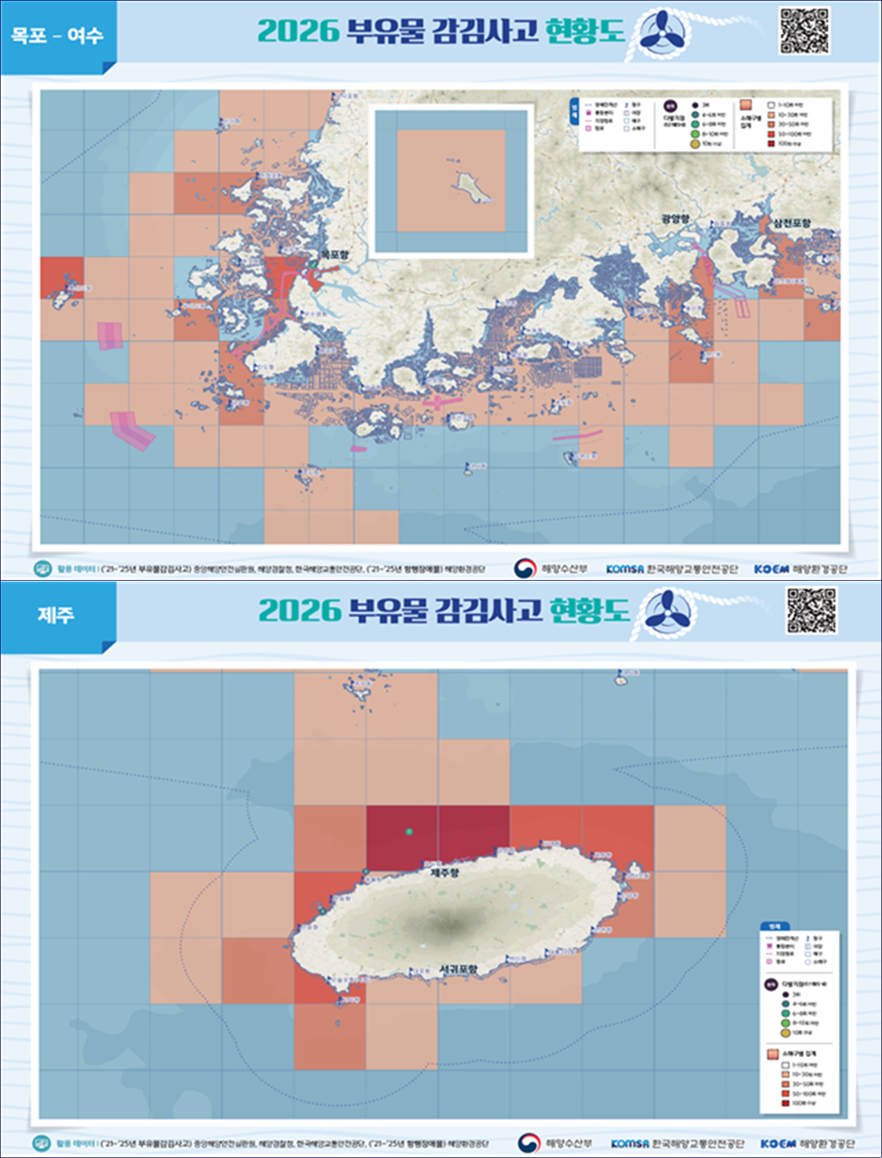
Six high-traffic coastal regions were analyzed in particular, with accident data broken down by season over the past five years: Incheon to Pyeongtaek, Daesan to Gunsan, Mokpo to Yeosu, Busan to Yeosu, Ulsan to Donghae, and Jeju.
On the maps, areas with frequent accidents are shaded in darker colors, allowing vessel operators to identify danger zones at a glance.
The ministry plans to print 2,000 copies of the paper map this year and distribute them to coastal ferry and fishing vessel operators through the Korea Maritime Transportation Safety Authority, the Korea Marine Environment Management Corp. and the National Federation of Fisheries Cooperatives' fishing vessel safety operations bureau.
The accident-prone zones will also be accessible through electronic navigation equipment used at sea. The relevant data will be displayed on the Badanavi app and on vessel GPS plotter screens. The maps will additionally be available on the Korea Maritime Transportation Safety Authority's Maritime Traffic Information System website.
"We hope that providing these maps will not only prevent entanglement accidents but also help ensure the safety of passengers using ferries and leisure fishing vessels," said Jeong Do-hyeon, director general of the ministry's Maritime Safety Bureau. "We will develop various ways to help more vessel operators make use of the maps."
adastra@heraldcorp.com