360-degree underwater footage, children's e-book unveiled; online platform revamped
AI applied to Chollian-2 satellite data; climate response forum set for Wednesday in Busan

Anyone curious about the underwater world around Dokdo can now explore it through 360-degree virtual reality footage — no trip to the islets required. Researchers are also pushing ahead with efforts to combine ocean, weather and atmospheric data gathered by different satellites to analyze climate change. From the seafloor to outer space, the ways marine science information is being put to use are expanding.
The Korea Institute of Ocean Science and Technology (KIOST) announced Tuesday that it has revamped its Dokdo Comprehensive Information System to let users explore the islets' natural environment and marine ecosystem online. Alongside this, KIOST will host a forum in Busan on Wednesday to discuss research findings from combining observational data from the Chollian-2 satellite series and chart the course for next-generation satellite development.
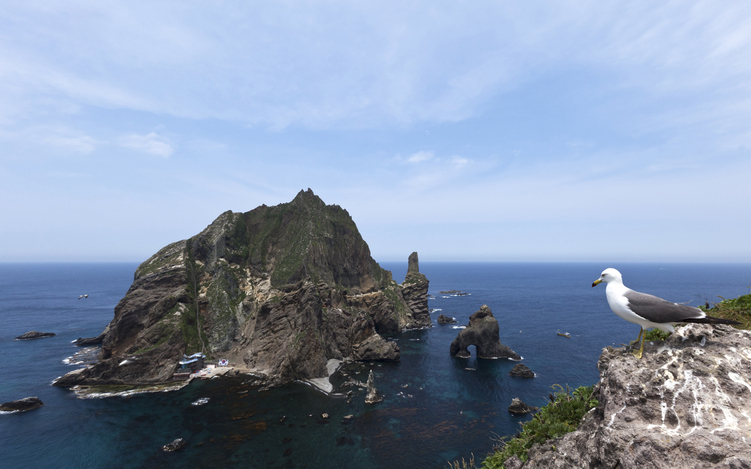
The Dokdo Comprehensive Information System is a marine science information platform that the Ministry of Oceans and Fisheries operates through KIOST. Since its launch in 2008, the platform has provided data on the marine environment, ecosystems and research findings in the waters surrounding Dokdo.
The most notable addition in the latest overhaul is an expansion of VR content offering a window into the underwater world around Dokdo. The update adds 360-degree underwater VR footage of the area around Jeoncha Rock to the existing video library, letting users take in the coastal underwater scenery and marine ecosystem of Dokdo — waters that are difficult to access in person.
Photos and videos of Dokdo and its surrounding waters have also been given more prominent placement. The interface and menus were reorganized to link content on the natural environment, marine ecosystems and scientific research findings, making it easier for users to find information on topics that interest them.
A new children's e-book — telling the story of Dokdo's marine life and natural environment through the adventures of a humphead wrasse named Pureum — has also been released, with an English edition available for international users.
KIOST has monitored changes in the marine environment and ecosystem around Dokdo since being designated the islets' dedicated research institution in 2006. The revamp is intended to make the body of research accumulated over those two decades more accessible to the general public.
"The Dokdo Comprehensive Information System is a channel through which KIOST shares with the public the fruits of our long years of Dokdo research," said Kim Chang-hwan, head of KIOST's Dokdo Research Center. "We will continue to investigate Dokdo's marine environment and ecosystem, and ensure that the public can experience those findings up close."
Satellites represent another frontier for marine science. KIOST will co-host the 8th Chollian-2 Convergence Application Conference in Busan on Wednesday together with the National Meteorological Satellite Center, the National Institute of Environmental Research and the Korea Hydrographic and Oceanographic Agency.
The event will bring together research findings from combining data from Chollian-2A, used for meteorological observation, and Chollian-2B, which monitors the ocean and environment. Because the ocean, atmosphere and weather constantly interact, the aim is to boost climate-change response capabilities by analyzing the data streams from both satellites in tandem.
Particularly notable will be case studies on processing and analyzing satellite data using AI and deep learning. KIOST plans to share results from a precision validation of observational data from GOCI-II, the ocean-color imager aboard Chollian-2B, and will also make the case for developing a successor instrument, GOCI-III.
Korea AeroSpace Administration, the Korea Hydrographic and Oceanographic Agency and the National Meteorological Satellite Center, among others, will outline development directions for next-generation ocean, meteorological and environmental satellites. Participating institutions will hold a separate working-level meeting on Thursday to discuss real-time satellite data exchange and ways to expand joint research.
"Ocean change interacts in complex ways with atmospheric and weather patterns, which means there are limits to what a single satellite's data can tell us," said KIOST President Lee Hee-seung. "Only when we fuse data observed from different perspectives by different institutions will we be able to find accurate answers to the complex challenges of the climate crisis."
adastra@heraldcorp.com