National average temperature of 15.8 C, 1.5 degrees above normal
Late-month cold snap sent temperatures plunging after mid-month records
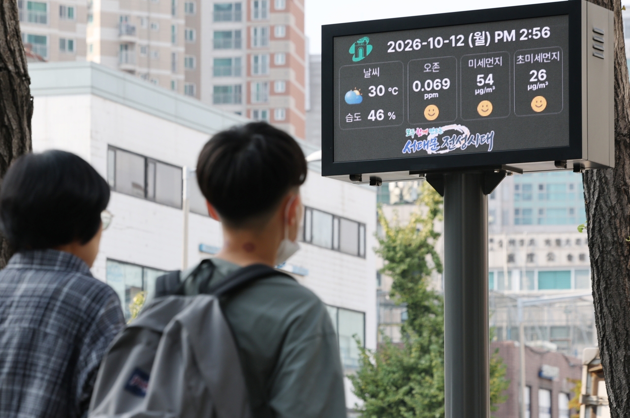
Last month brought sharp temperature swings, with abnormal warmth and near-winter cold alternating throughout October. Rainfall exceeded normal levels, yet a meteorological drought persisted due to the shortfall in summer precipitation.
According to the Korea Meteorological Administration's "October 2026 Climate Characteristics" report released Wednesday, the national average temperature last month was 15.8 C — 1.5 degrees above the historical norm of 14.3 C. It was, however, 0.8 degrees lower than last October's 16.6 C, which remains the hottest October on record.
Temperatures climbed sharply in the middle of the month before dropping steeply in the final stretch. The mid-month national average of 17.9 C was the second highest on record for that period.
Abnormally high temperatures were recorded across most of the country during Oct. 10–12 and Oct. 16–17. A high-pressure circulation that developed in the upper atmosphere drew in warm air, pushing temperatures well above normal.
On the 12th in particular, Seoul's daily high reached 30.1 C, breaking the city's all-time October daily maximum record. Daejeon (31.5 C), Jeongeup (31.1 C) and Gumi (30.0 C) also set new records that day.
In the latter part of the month, cold air pushing down from the north caused temperatures to fall sharply. A blocking pattern that developed from the Nordic region to the area near the Ural Mountains stalled atmospheric circulation, allowing an upper-level cold trough to advance rapidly southward. On Oct. 22, minimum temperatures in the central inland regions and northern North Gyeongsang Province dropped more than 5 degrees below normal.
Temperatures briefly recovered before plunging again from the 27th, producing a series of rapid swings within a short period. The KMA said the wide temperature variability throughout October resulted from the country alternating between cold and warm air masses within mid-latitude atmospheric flows, compounded by the development of blocking near the Ural Mountains in the latter part of the month.
Rainfall 1.7 times normal, yet drought conditions persist
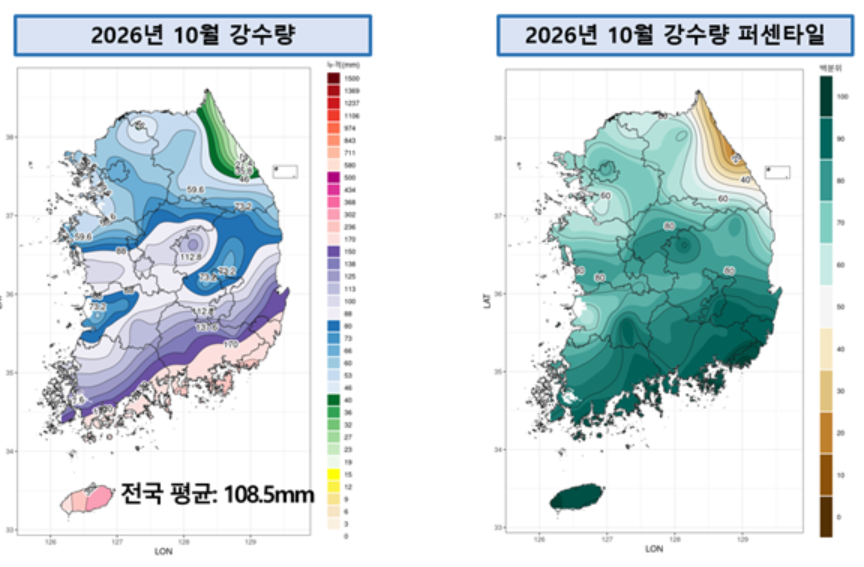
Rainfall was also above average last month. The national total of 108.5 millimeters was about 1.7 times the historical norm of 63.0 millimeters, and the number of rainy days reached 8.6 — 2.7 days more than normal. However, conditions varied considerably by period: the early part of the month was dry, while rain was concentrated in the middle and latter portions.
Precipitation in the first 10 days was limited to just 0.5 millimeters nationwide, the third lowest on record for that period. By contrast, warm and humid air flowing in during the middle and latter parts of the month, combined with frequent influence from upper-level pressure troughs, brought repeated rainfall. During Oct. 23–26 in particular, Typhoon Champi, the 30th named storm of the year, tracked from Taiwan toward the Kyushu region of Japan, channeling large amounts of moisture into the peninsula. With an additional pressure trough reinforcing the system, prolonged rain fell mainly across the Chungcheong region and areas to the south.
Despite the heavy rainfall, meteorological drought conditions continued. The number of drought days nationwide last month reached 18.5, the fourth highest on record. Because meteorological drought is assessed based on cumulative precipitation over the preceding six months, the summer rainfall deficit continued to weigh on conditions. Cumulative national precipitation from May through October this year was limited to 77.3 percent of the historical norm.
Korea Meteorological Administration Commissioner Lee Mi-seon said October this year showed dramatic weather swings, with both temperature and precipitation varying widely within a single month. "We will strengthen preparedness against hazardous winter weather and closely monitor evolving climate patterns to enhance our proactive response to abnormal climate events," she said.
newday@heraldcorp.com