As this year's Ulchi CPX brought drone-attack defense drills to major regions across the country, including Gangwon Province, Gangwon and the city of Donghae have been moving in parallel to build a civilian drone safety network of their own.
Gangwon Special Self-Governing Province and Donghae announced Monday that they have launched a "drone disaster safety network" project, integrating smart urban regeneration technology into real-world disaster and safety operations.
Drones have emerged as a double-edged sword for civilian communities and battlefields alike. Gangwon Province has already put the technology to work across a range of civilian uses — agriculture, remote-area delivery and wildfire suppression — and Donghae has now extended that to preventive surveillance, using drones to detect potential disaster risks before they escalate. On the military side, South Korean forces stationed in Gangwon and elsewhere have developed drone technology to a world-class level.
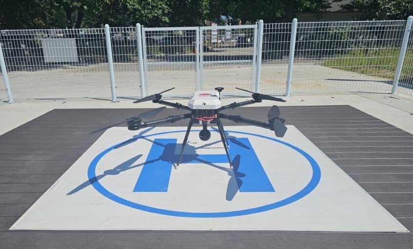
Donghae, working with Gangwon Province's urban regeneration division, invested a total of 410 million won ($294,000) to complete the installation of two smart drones and a disaster surveillance and wildfire monitoring system in the Samhwa district, and has begun autonomous flight operations.
The project was carried out under the Ministry of Land, Infrastructure and Transport's public-offering program for lifestyle-oriented urban regeneration smart technology support. It marks the first time a drone-based disaster surveillance system has been introduced as part of an urban regeneration project. The initiative focuses on supplementing the existing personnel-centered patrol system, reducing blind spots in monitoring coverage and securing the critical response window in disaster situations.
To ensure safe and professional operations, Donghae obtained special flight approval from the Ministry of Land, Infrastructure and Transport and assigned certified pilots holding Class 1 multicopter qualifications. The drones conduct six autonomous flights per day along designated surveillance zones, scanning for wildfire risks and other potential disaster hazards.

The drones use thermal imaging and high-definition video equipment to detect early warning signs such as smoke and abnormal temperatures, and to conduct three-dimensional surveillance of areas difficult for people to access.
Live footage can be monitored at Donghae's Safety Information Center and drone center, and can be shared with relevant agencies including police and fire departments when needed, allowing for faster situational assessment and response in the event of a disaster.
Building on operational results, Donghae plans to expand drone use beyond wildfire monitoring to cover a broader range of disaster and safety applications — including searches for missing persons — as it works to advance its smart disaster response system.
The project is also notable as a model of provincial-municipal collaboration, with Gangwon Province integrating smart technology into urban regeneration and Donghae implementing it as a real-world disaster safety system. The initiative is drawing attention for its potential to extend the scope of urban regeneration from physical environmental improvement to smart services that protect residents' daily lives and safety.
Lee In-seop, head of Donghae's safety division, said the collaboration with Gangwon Province's urban regeneration department had turned smart urban technology into a working system for protecting residents. "Going forward, we will accumulate operational data and strengthen coordination with police, fire departments and other relevant agencies to develop this into a smart safety network capable of responding to a wide range of disaster situations — from wildfires to searches for missing persons," he said.
abc@heraldcorp.com